Log in
All resources
Create a design
11,660 Free Images of Old Map
atlas de wit 1698
1552
geographiae claudii ptolemaei alexandrini (münster
fonds ancely - bibliothèque municipale de toulouse - maps
victor levasseur - maps of france
atlas van der hagen
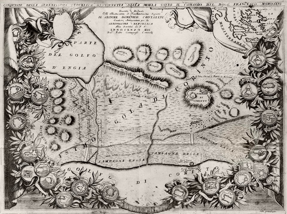
geographical illustrations by coronelli
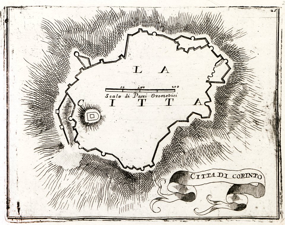
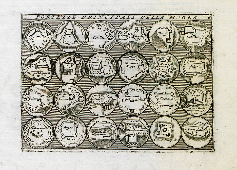
old maps of the peloponnese
maps with cartouches
files from the bodleian libraries
historical images of minsk
old maps of minsk
old maps of lake constance
reichenau island
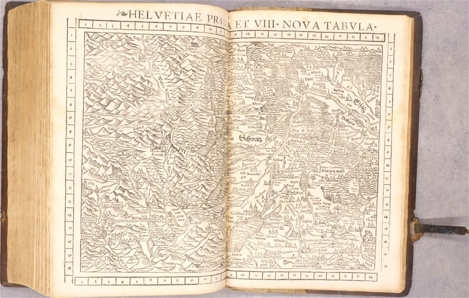
old maps of switzerland
1552
pictorial maps
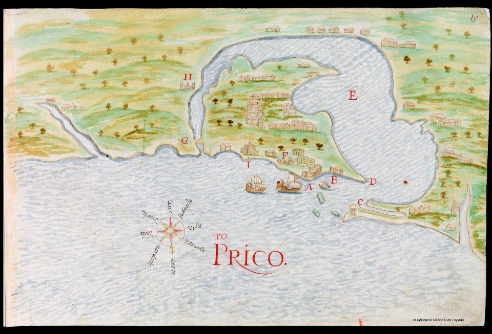
puerto rico
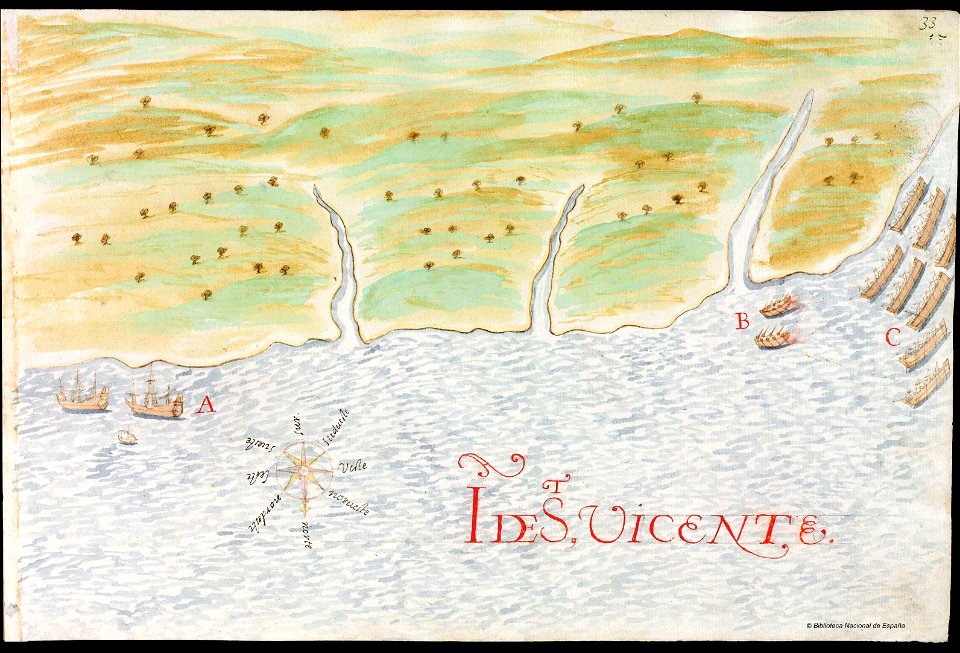
history of saint vincent and the grenadines
pictorial maps
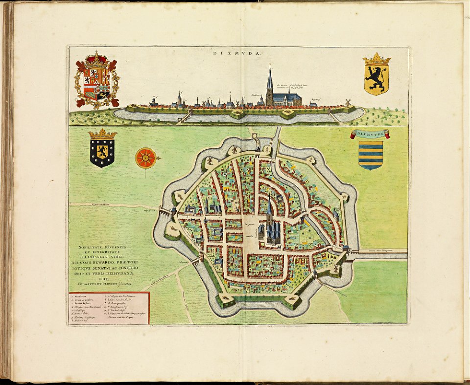
old maps of diksmuide
atlas de wit 1698
files from the bodleian libraries
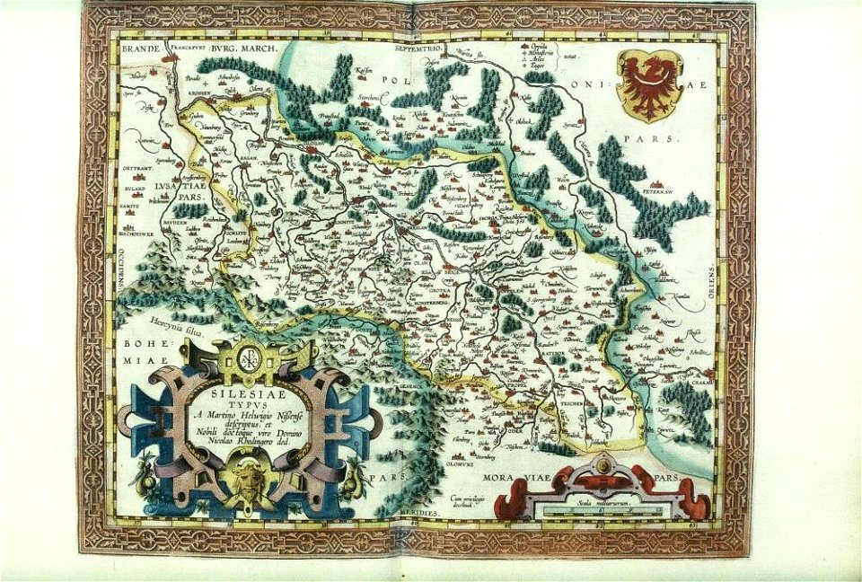
old maps of silesia
files from the bodleian libraries
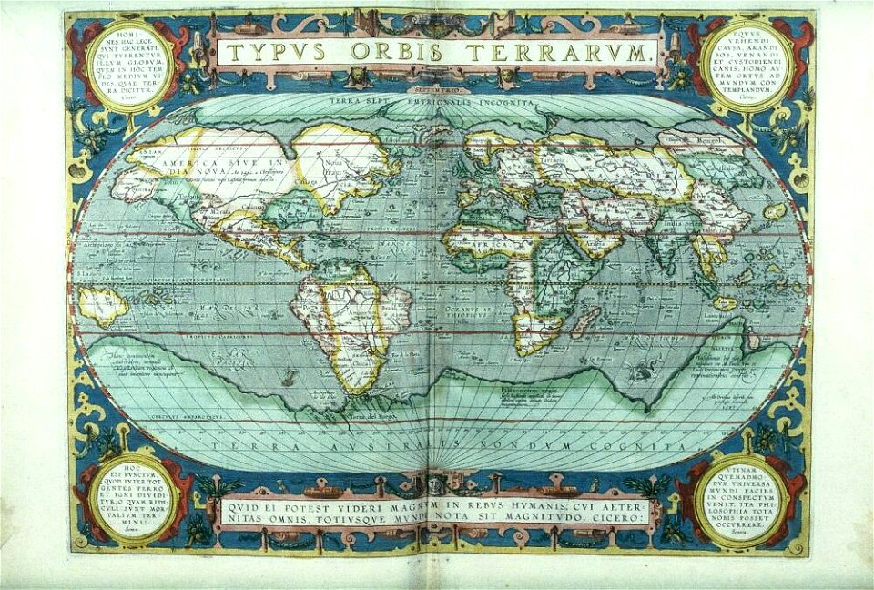
old maps of the world
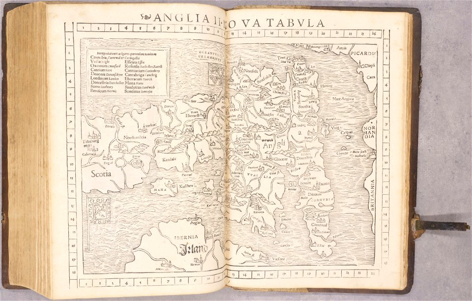
old maps of england
1552
old maps of france
1552
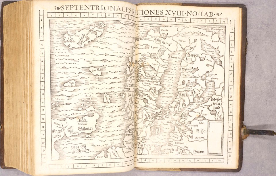
old maps of scandinavia
1552
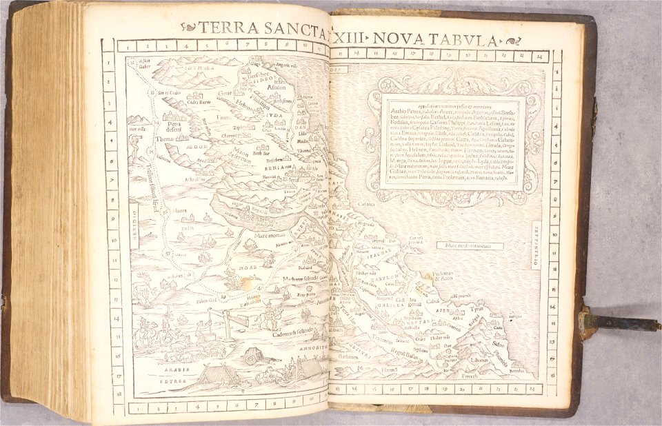
old maps of palestine
1552
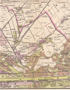
breitenlee
aspern
geographical illustrations by coronelli
old maps of the peloponnese
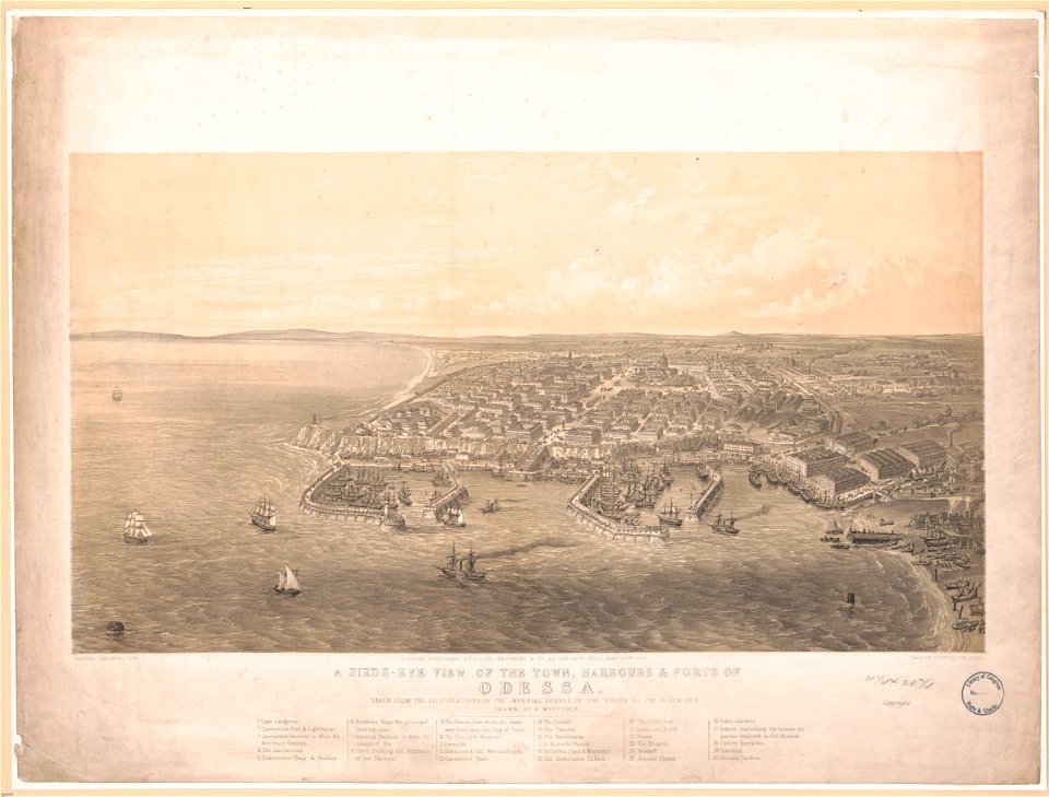
maps by george h. walker and company
graphische sammlung der zentralbibliothek zürich
old maps of zürich
louis-françois cassas
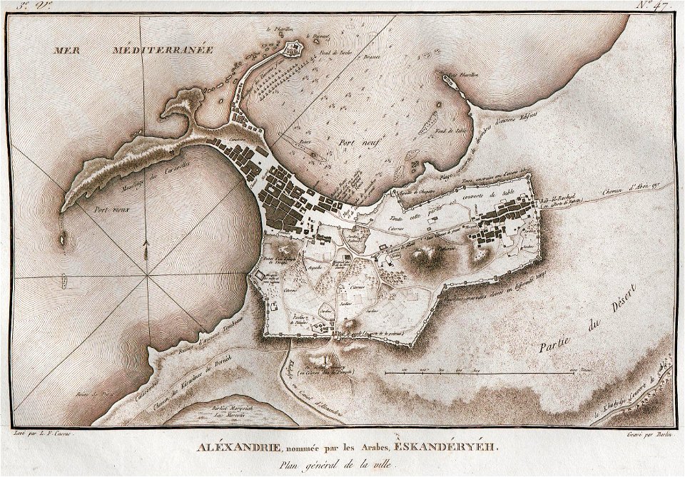
alexandria
old maps of istanbul
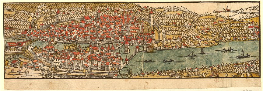
hartmann schedel
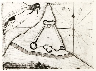
geographical illustrations by coronelli
old maps of the peloponnese
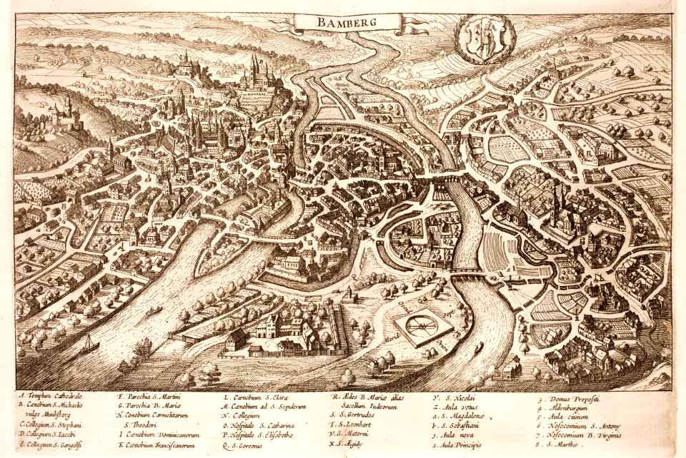
history of bamberg
bamberg
old maps of hulst
atlas beudeker
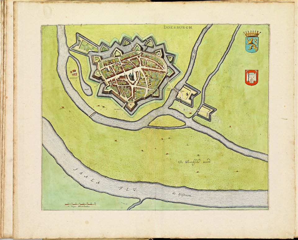
old maps of doesburg
atlas de wit 1698
old maps of zutphen
atlas de wit 1698
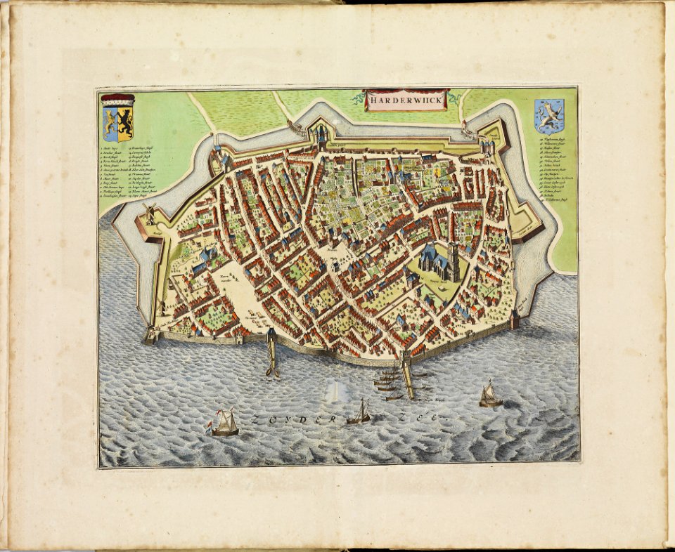
old maps of harderwijk
atlas de wit 1698
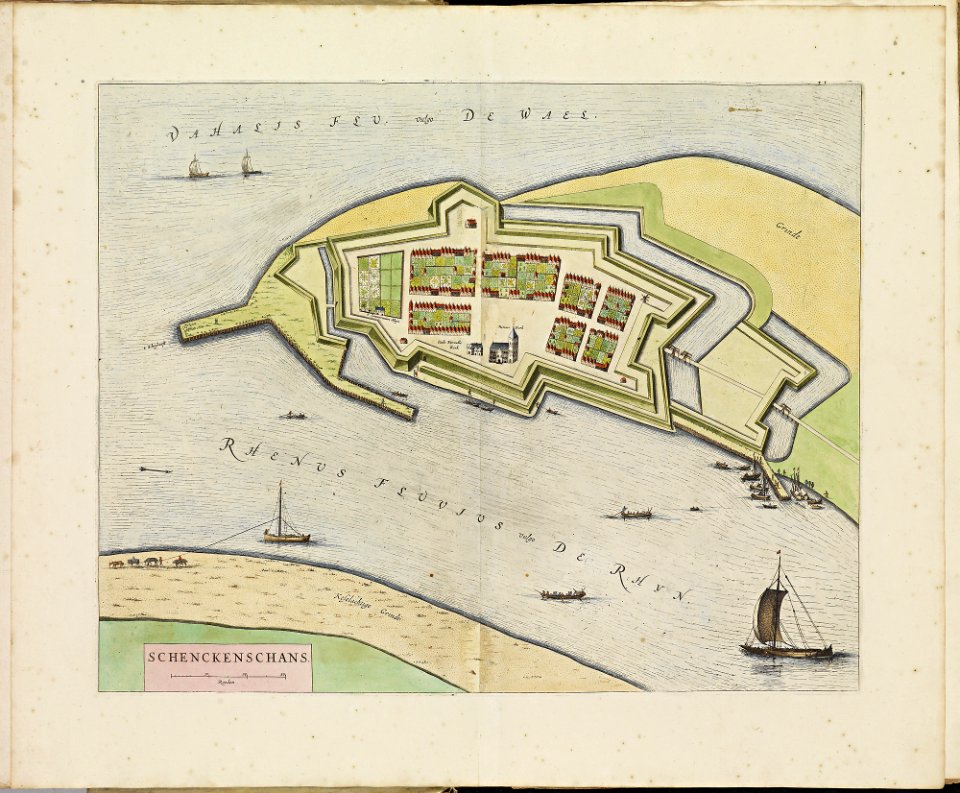
old maps of schenkenschans
atlas de wit 1698
old maps of dordrecht
atlas de wit 1698
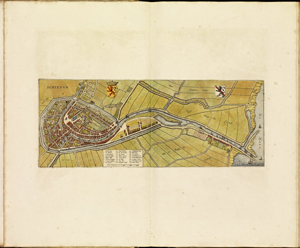
old maps of schiedam
atlas de wit 1698
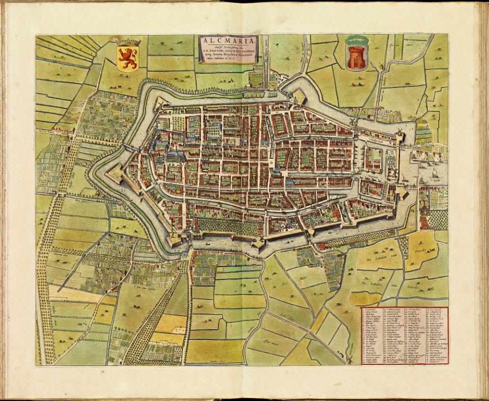
old maps of alkmaar
atlas de wit 1698
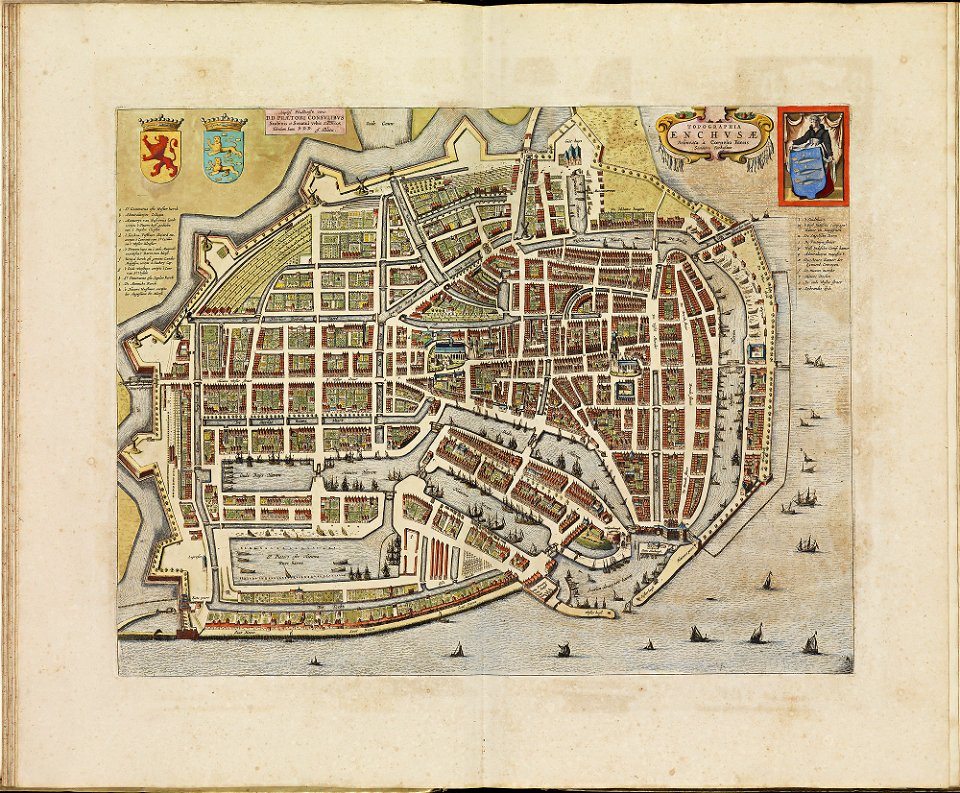
old maps of enkhuizen
atlas de wit 1698
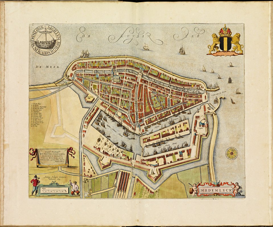
old maps of medemblik
atlas de wit 1698
old maps of monnickendam
atlas de wit 1698
atlas de wit 1698
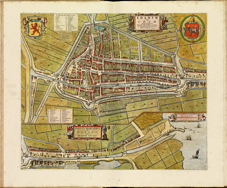
old maps of edam
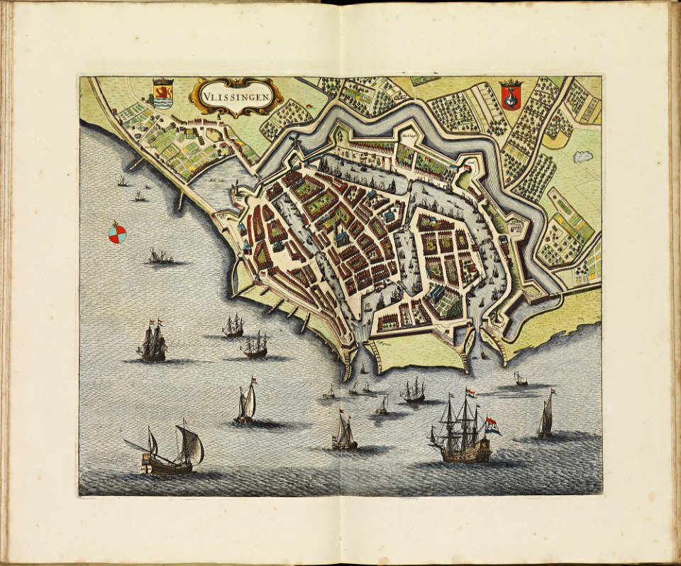
old maps of vlissingen
atlas de wit 1698
atlas de wit 1698
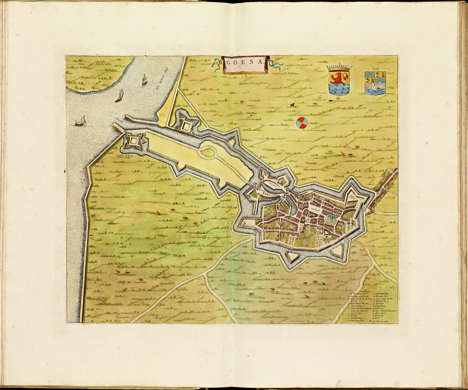
old maps of goes
old maps of oldenzaal
atlas de wit 1698
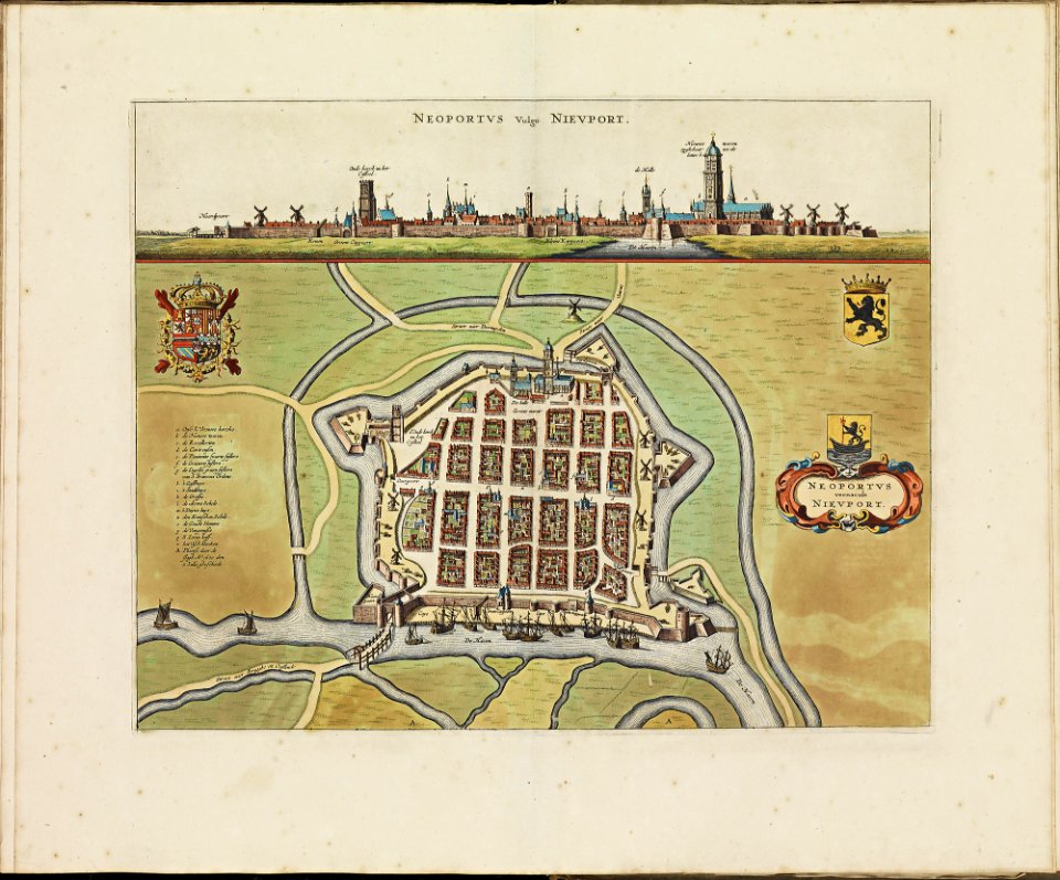
old maps of nieuwpoort
atlas de wit 1698
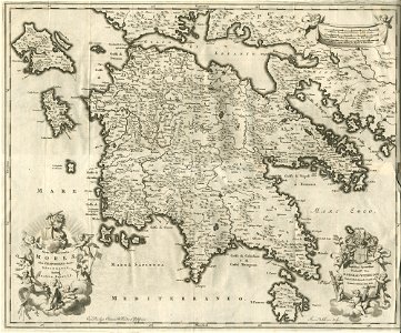
old maps of greece
olfert dapper
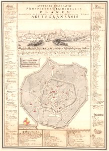
johann joseph couven
old maps of aachen
geographical illustrations by coronelli
old maps of the peloponnese
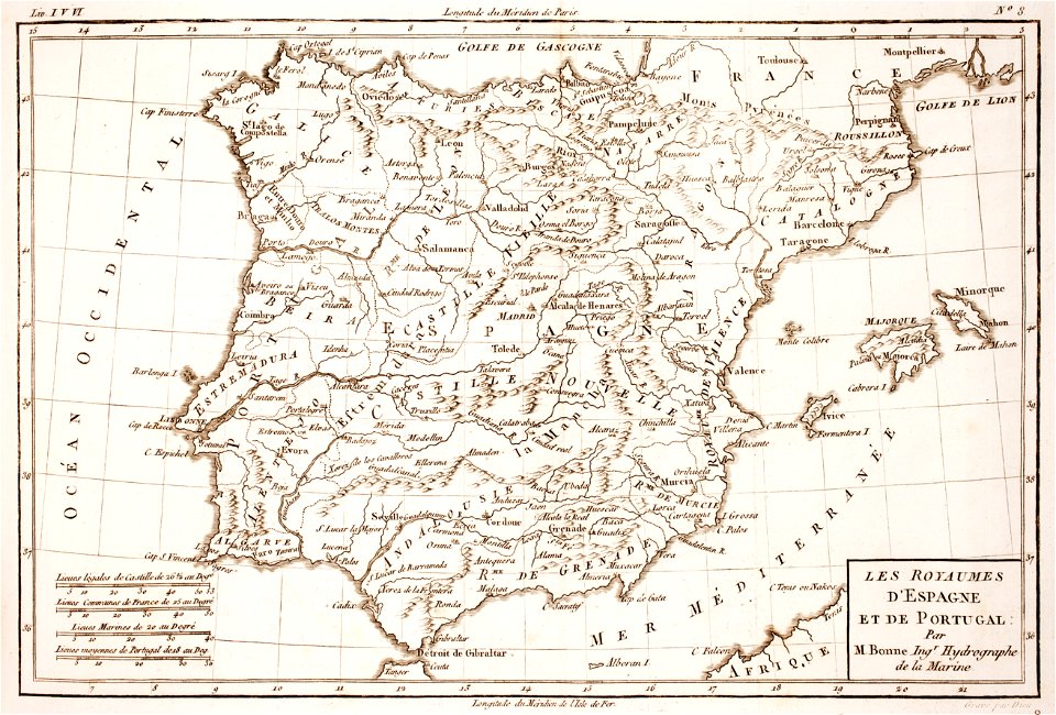
1780s maps of portugal
1780s maps of spain
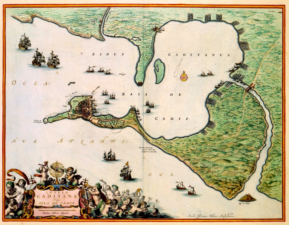
maps by willem and johannes blaeu
maps made in the 17th century
fonds ancely - bibliothèque municipale de toulouse - maps
frédéric-auguste laguillermie
coats of arms of rhône
louis gabriel suchet
fonds ancely - bibliothèque municipale de toulouse - maps
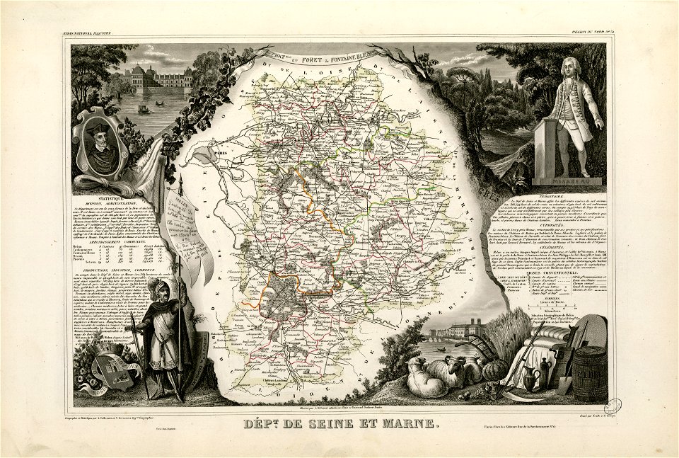
victor levasseur - maps of france
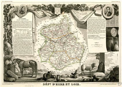
old maps of seine-et-marne
honoré mirabeau
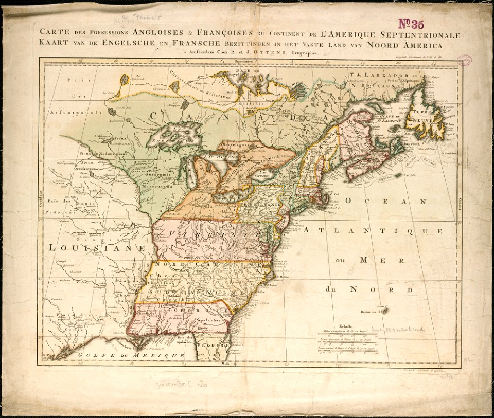
old maps of north america from the norman b. leventhal map center
1755 maps of the united states
university of toronto wenceslas hollar digital collection
staffordshire
maps with cartouches
old maps of france
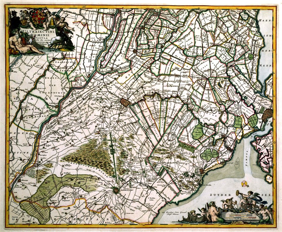
atlas van der hagen
copper engraving
maps with cartouches
atlas van der hagen
prints in the teylers museum
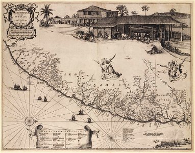
old maps of pernambuco
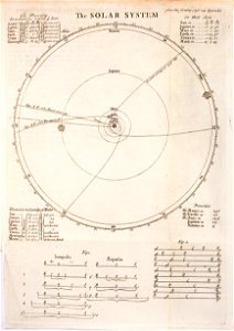
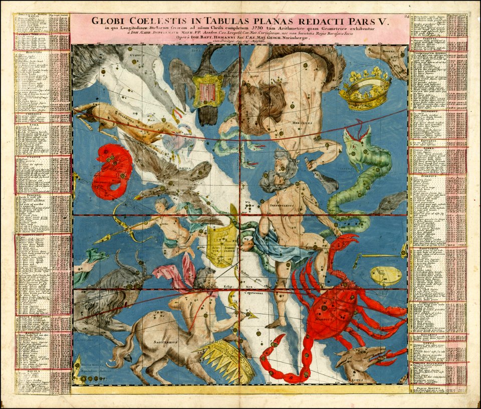
old celestial maps
comet
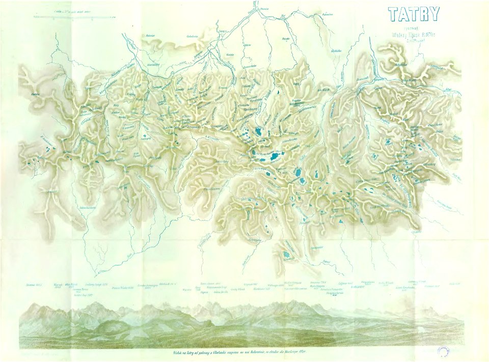
illustrowany przewodnik do tatr
pienin i szczawnic
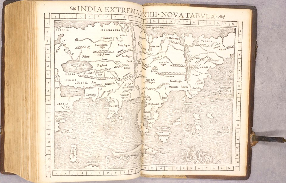
old maps of asia
1552
old maps of bohemia
1552
old maps of transylvania
1552
old maps of the americas
1552
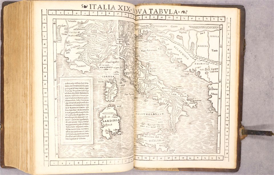
old maps of italy
1552
geographical illustrations by coronelli
old maps of the peloponnese
old maps of havana
cuba in the 1860s
files from the bodleian libraries
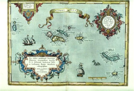
old maps of the azores
corsica (galleria delle carte geografiche)
old maps of corsica
johann gabriel doppelmayr
old celestial maps
old maps of nijmegen
atlas de wit 1698
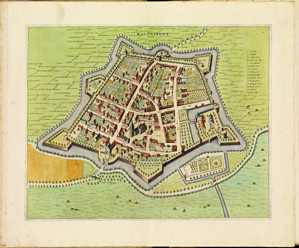
old maps of wageningen
atlas de wit 1698
atlas de wit 1698
old maps of tiel
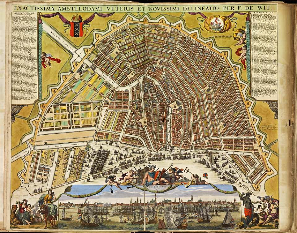
old maps of amsterdam
atlas de wit 1698
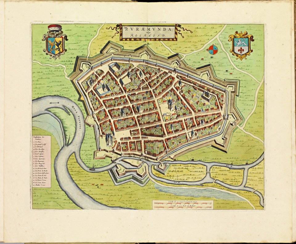
old maps of roermond
atlas de wit 1698
atlas de wit 1698
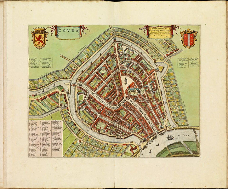
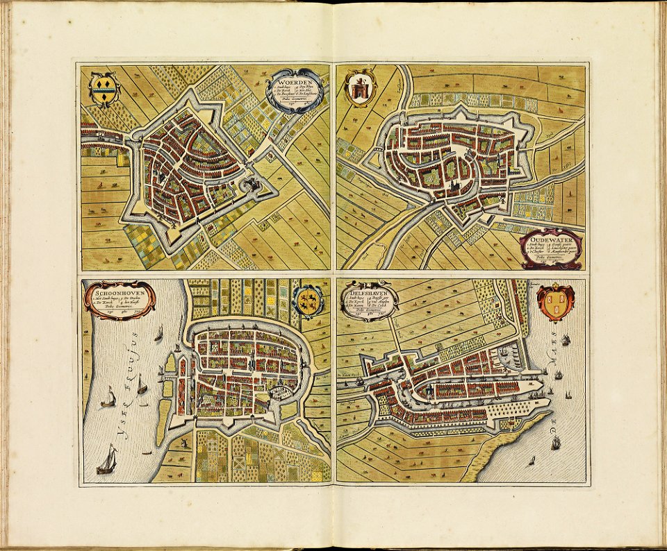
old maps of gouda
atlas de wit 1698
old maps of delft
old maps of schoonhoven
atlas de wit 1698
atlas de wit 1698
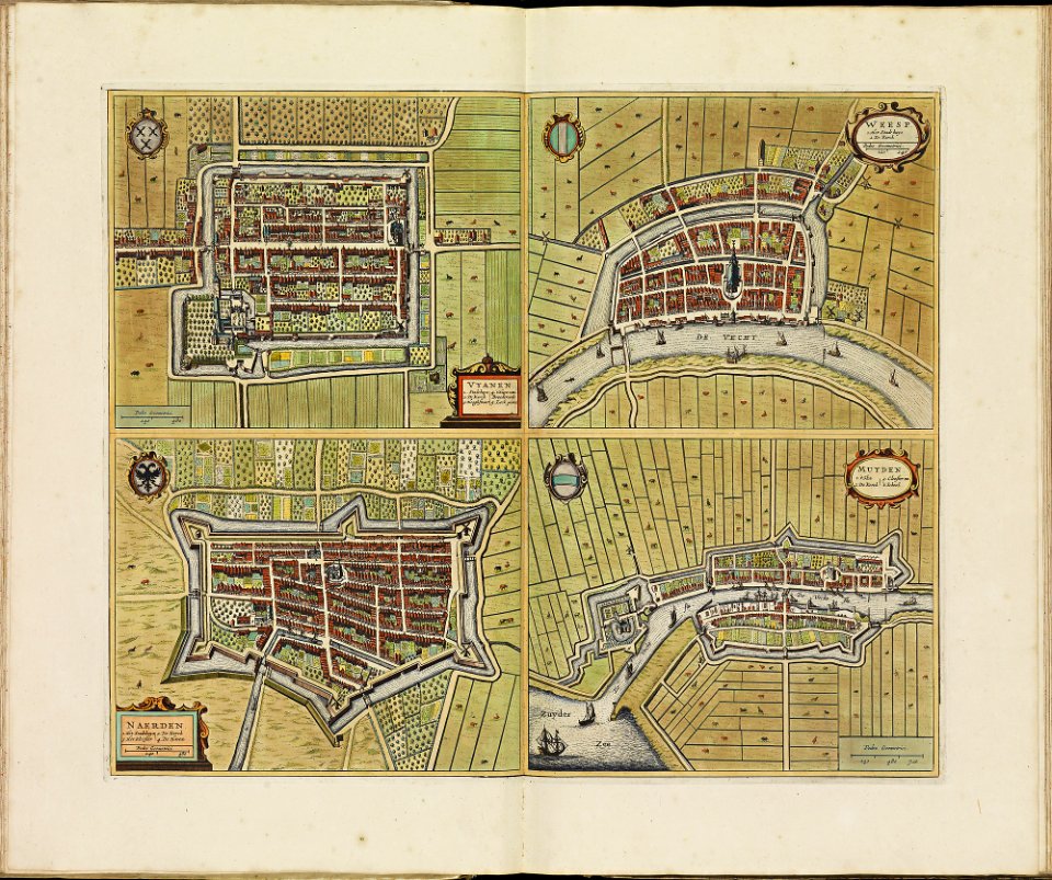
old maps of weesp
atlas de wit 1698
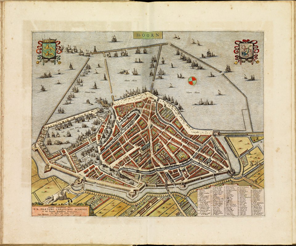
old maps of hoorn
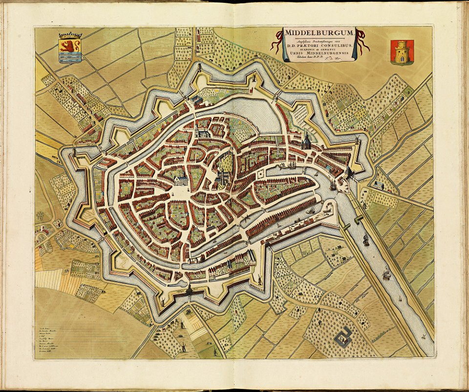
old maps of middelburg
atlas de wit 1698
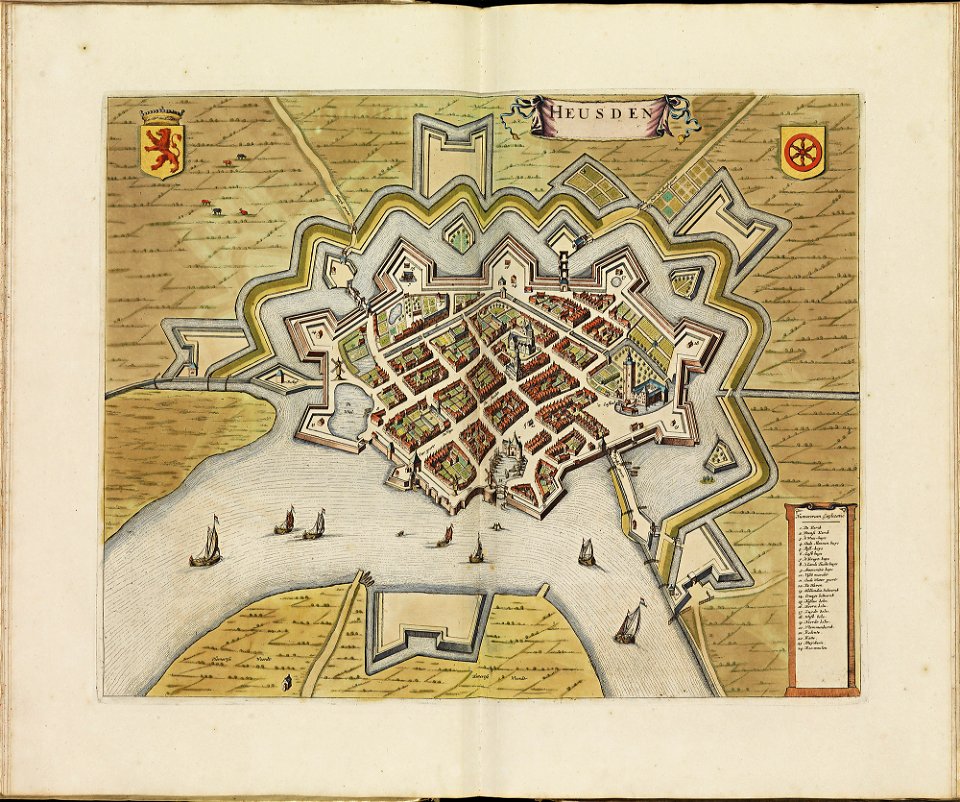
old maps of heusden
atlas de wit 1698
old maps of woerden
atlas de wit 1698
atlas de wit 1698
old maps of sneek
old maps of dokkum
atlas de wit 1698
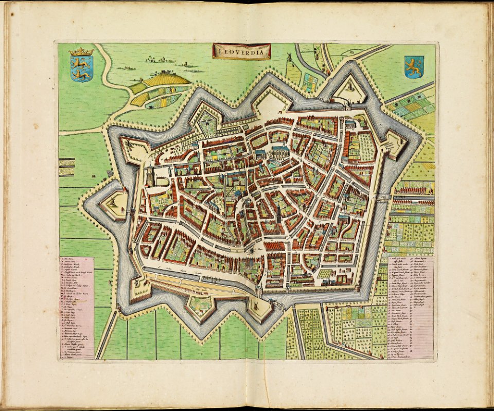
old maps of leeuwarden
atlas de wit 1698
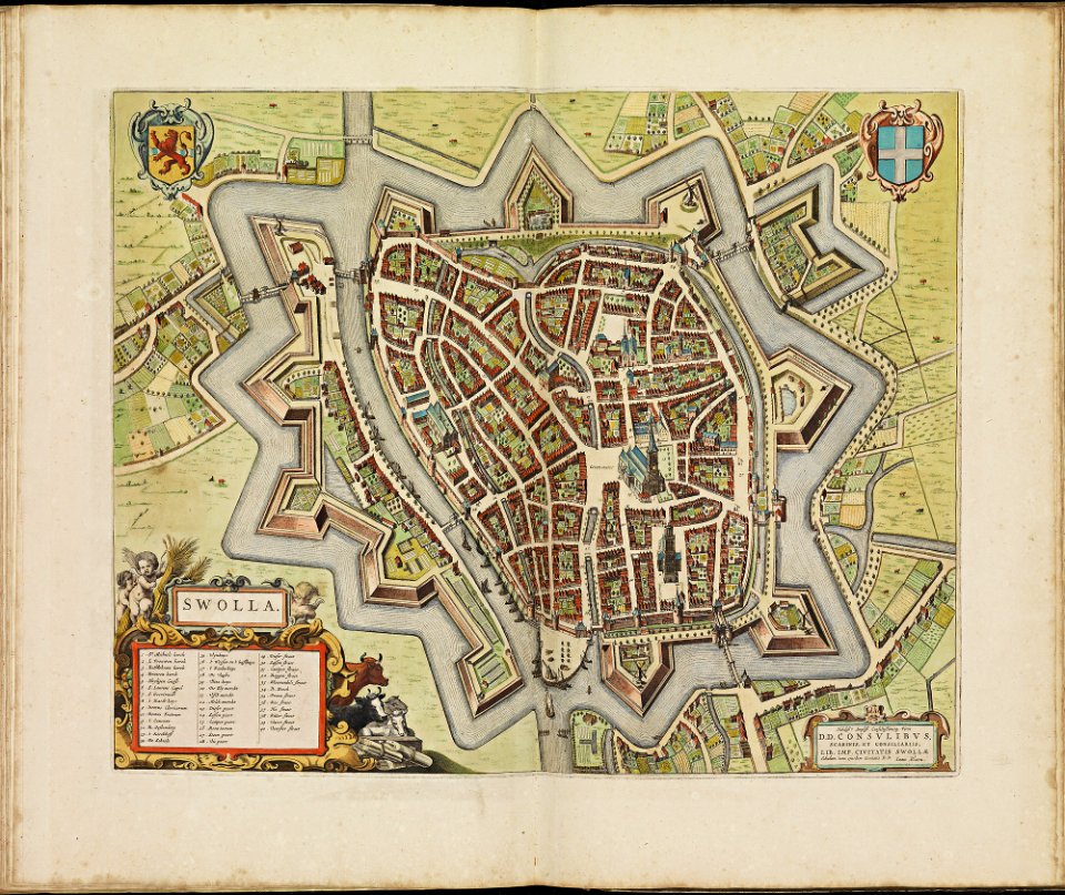
old maps of zwolle
atlas de wit 1698
old maps of harlingen
atlas de wit 1698
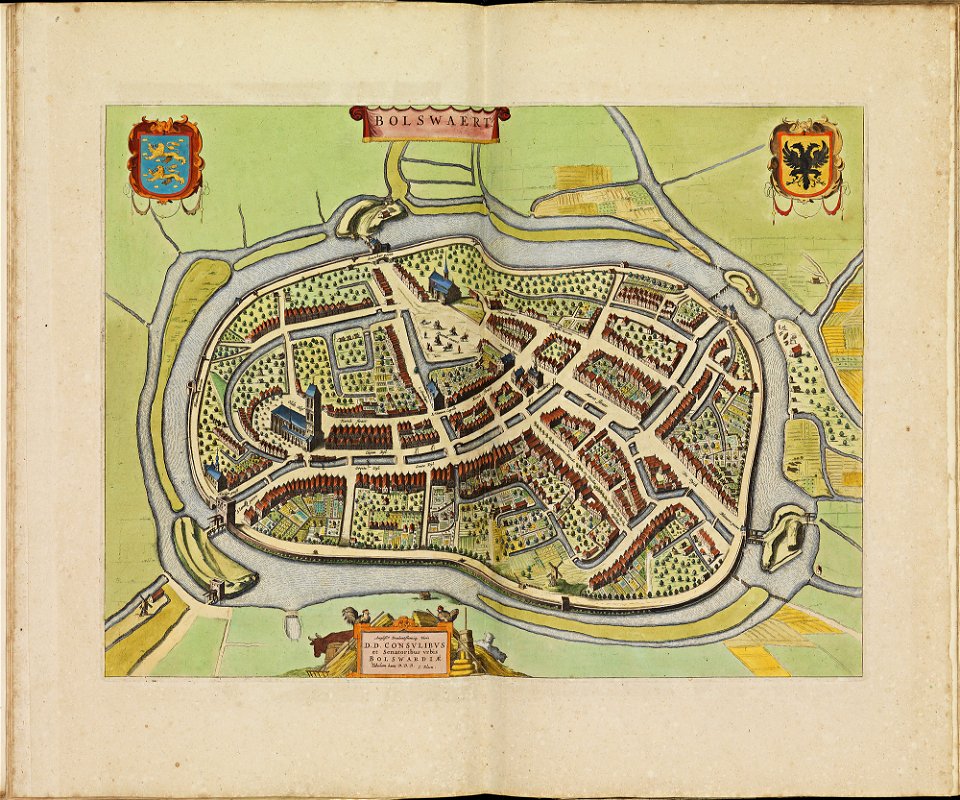
old maps of bolswaart
atlas de wit 1698
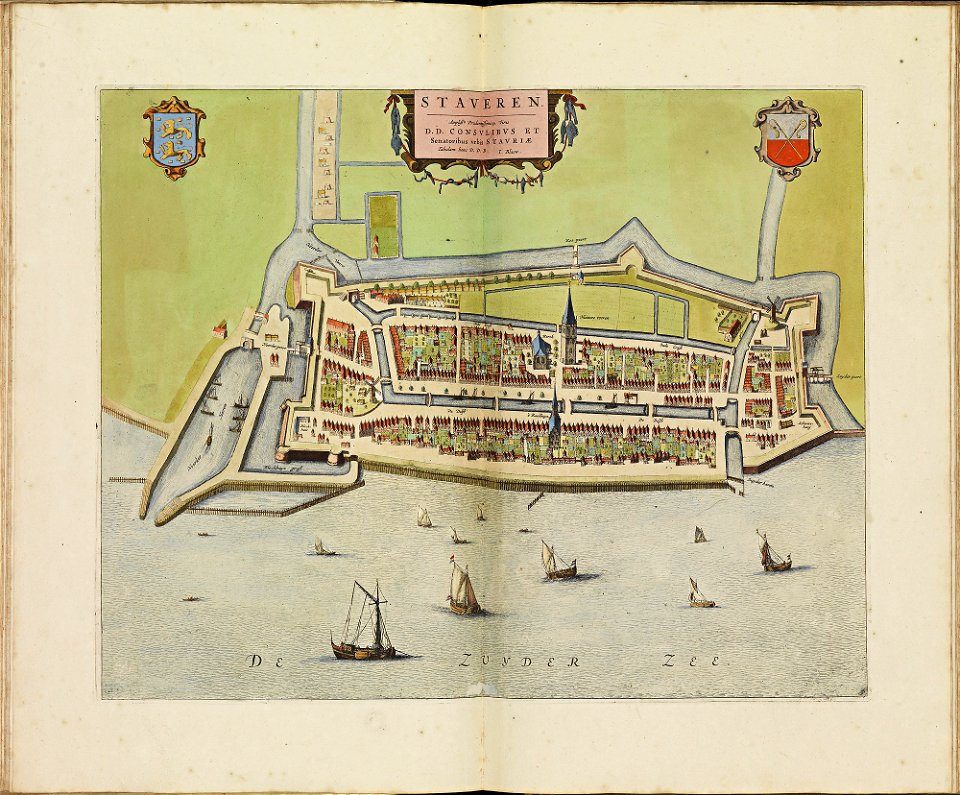
old maps of stavoren
atlas de wit 1698
atlas de wit 1698
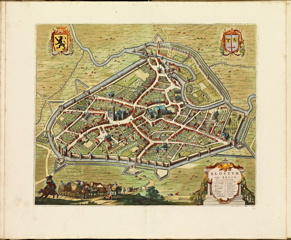
old maps of aalst
geographical illustrations by coronelli
old maps of the peloponnese
portraits of jean racine
history of soissons
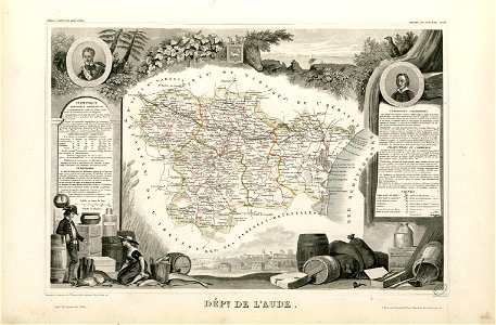
coats of arms of cities in aude
coats of arms of aude
françois-antoine de boissy d'anglas
frédéric-auguste laguillermie
coats of arms of cities in hautes-pyrénées
bertrand barère de vieuzac
18th-century maps of brazil
1780 in south america
maps made in the 17th century
frederick de wit
maps made in the 18th century
johann baptist homann
maps with cartouches
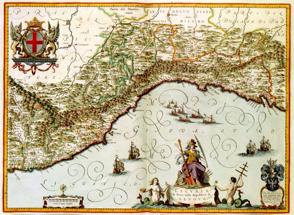
old maps of genoa
old maps of amsterdam
maps with cartouches
maps by willem and johannes blaeu
circumvallation
prints in the royal collection of the united kingdom
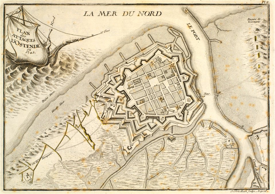
history of ostend
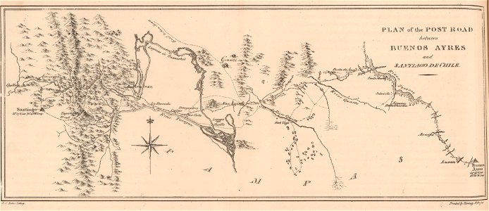
19th-century maps of argentina
1820s lithographs
maps made in the 18th century
johann baptist homann
vintage
maps
atlas van der hagen
old maps of france
3901 - 4000 of 11,660
Next page
/ 117